Map available as Digital Download or Printed A3, A2, A1 (laminated optional)
MAPS & CHARTS > Far North Queensland History Series by Dr Timothy Bottoms
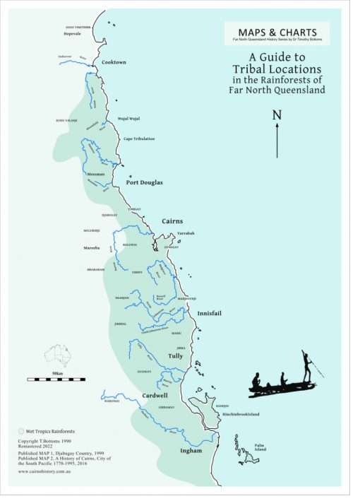
Shows approximate tribal locations for the greater Cairns area. The map includes 30 Bama names for places and landscape features (rivers, mountains, islands, etc) including the Great Barrier Reef. Also included are the years of settlement for townships, the locations of regional massacre sites and native police camps.
Published 1999, 2016, 2018